Location-Specific Watershed Management, Sustainable Water Resources, and Community-Based Biodiversity Conservation in BARMM
The sustainable management of watersheds and aquatic ecosystems requires scientific understanding of local environmental conditions, biodiversity, water resources, and the communities that depend on them. Recognizing this, Mindanao State University–Maguindanao has strengthened its institutional initiatives on watershed management, aquatic biodiversity conservation, forest protection, and sustainable natural resource management through research, environmental assessment, management planning, stakeholder engagement, and partnerships with government agencies and local communities.
A major initiative demonstrating this commitment is the South Upi Forest Watershed Enhanced Protection and Management Plan (2025–2030), developed through a research project funded by the Ministry of Science and Technology–Bangsamoro Autonomous Region in Muslim Mindanao (MOST–BARMM). Complementing this initiative are research and environmental management activities involving Ligawasan Marsh, Lake Buluan, the Rio Grande de Mindanao, and Lake Lanao. These initiatives integrate location-specific environmental information, biodiversity considerations, community knowledge, and institutional collaboration to support the protection of watersheds and the sustainable management of aquatic resources.
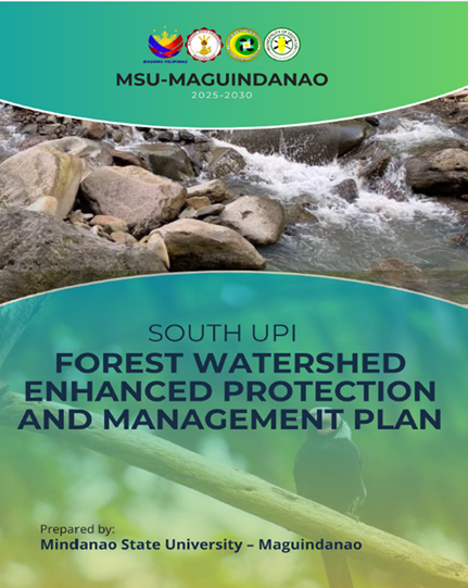
South Upi Forest Watershed Enhanced Protection and Management Plan (2025–2030)
A major institutional contribution to sustainable watershed management is the development of the South Upi Forest Watershed Enhanced Protection and Management Plan (2025–2030) under the MOST–BARMM-funded research project entitled “Characterization of South Upi Forest Watershed cum Landslide Vulnerability Assessment: Basis for Enhanced Protection and Management Plan.”
The project covers approximately 1,894 hectares across five barangays—Romangaob, Looy, Bongo, Kigan, and Pandan—in the Municipality of South Upi, Maguindanao del Sur. The preparation of the management plan involved baseline data collection, geographic mapping, biodiversity and habitat profiling, field observations, and assessment of environmental conditions and landslide vulnerability.
The assessment identified environmental concerns affecting the watershed, including illegal logging, land conversion, unsustainable farming practices, soil erosion, landslide risks, biodiversity loss, and potential water quality degradation. These findings provided the scientific basis for identifying appropriate management interventions responsive to the ecological characteristics and environmental pressures of the area.
The resulting five-year management plan establishes priority strategies covering:
- Watershed zoning and protection to safeguard critical watershed areas and environmentally sensitive locations.
- Sustainable land-use management to minimize forest degradation, soil erosion, and environmental risks.
- Forest rehabilitation and agroforestry through assisted natural regeneration, agroforestry practices, and native species planting.
- Biodiversity and habitat conservation to protect forest habitats and indigenous biological resources.
- Water resource management to protect water sources and maintain watershed functions and water quality.
- Community-based environmental protection through local participation in conservation and sustainable resource management.
- Environmental monitoring and institutional coordination to support biodiversity assessment, environmental education, local enforcement, and long-term watershed management.
The plan provides a location-specific management framework that considers the actual environmental conditions, land-use characteristics, and conservation priorities of the South Upi Forest Watershed. It also recognizes the relationship between forest protection, watershed functions, water resources, and the aquatic ecosystems that depend on healthy watersheds.
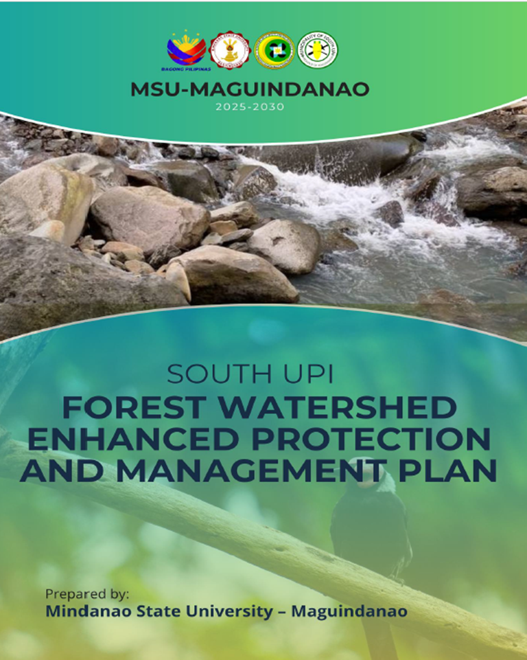
South Upi Forest Watershed Enhanced Protection and Management Plan (2025–2030), developed through the MOST–BARMM-funded research project, providing a five-year framework for watershed protection, forest rehabilitation, biodiversity conservation, and sustainable natural resource management.
Field Assessment and Community Participation in Watershed Protection
Community participation was an important component of the South Upi watershed characterization and management planning process. Field assessment and stakeholder consultation activities involved local government representatives, Indigenous Teduray communities, farmers, and other stakeholders in gathering information about watershed conditions, identifying environmental concerns, and determining appropriate management priorities.
Through collaboration with MOST–BARMM and local stakeholders, the University incorporated community perspectives into the assessment and planning process. The participation of Indigenous communities and local resource users recognizes the importance of traditional knowledge and local experience in protecting forest resources, maintaining watershed functions, and addressing environmental pressures affecting the area.
These activities strengthened coordination among the University, local government units, environmental agencies, and communities, providing a foundation for continued cooperation in watershed protection and sustainable natural resource management.
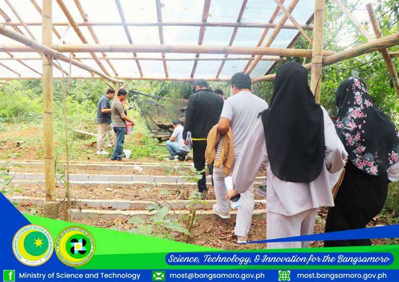
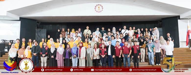
MSU–Maguindanao and MOST–BARMM research team members with local government representatives and members of the Indigenous Teduray community during field assessment and stakeholder consultation activities for the South Upi Forest Watershed Enhanced Protection and Management Plan.
Strengthening Local Capacity Through Advanced QGIS Training
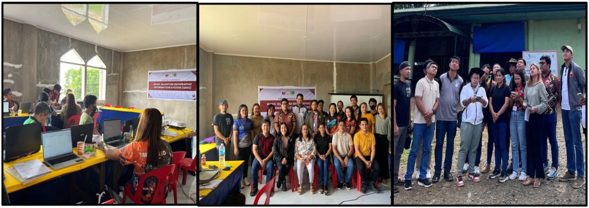
Effective watershed management requires reliable environmental information and the technical capacity to assess changes in land use, forest cover, and watershed conditions. To support these requirements, the University conducted the Application Training on Advanced Quantum Geographic Information System (QGIS) on February 5–7, 2025, at Balay Silangan Conference Hall in Nuro, Upi.
The training was attended by personnel from the Local Government Units of South Upi and North Upi and the Ministry of Science and Technology (MOST). It focused on geospatial applications for watershed management, landslide vulnerability assessment, and the preparation of Land Use and Land Cover (LULC) maps.
Assoc. Prof. Peter Jan D. De Vera, the project leader, facilitated the LULC mapping session, while For. Kristine Joy B. Rendon conducted a refresher session on QGIS fundamentals.
The training strengthened the technical capacity of local partners to use geospatial information in land-use assessment, environmental planning, spatial analysis, and future watershed monitoring. These capabilities are important in supporting the implementation, monitoring, and periodic updating of the South Upi Forest Watershed Enhanced Protection and Management Plan.
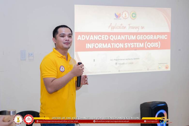
Local government and MENRE personnel participating in the Advanced QGIS Training on February 5–7, 2025, to strengthen technical capacity in watershed mapping, land-use assessment, and environmental planning.
Community-Based Conservation of Indigenous Fish and Crop Resources
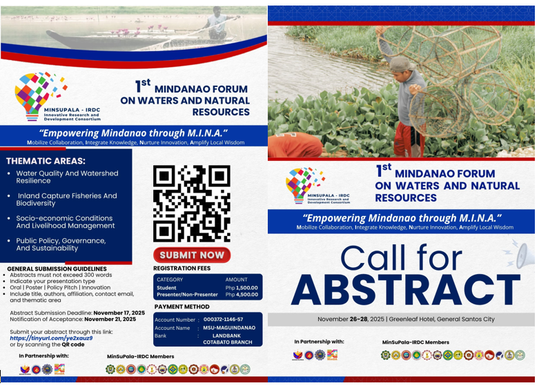
The University's biodiversity conservation initiatives also extend to the identification and preservation of indigenous biological resources through the MinSuPala–IRDC Phase 2 project entitled “Establishment and Preservation of Indigenous Fish and Crop Products.”
From July 23–25, 2025, coordination and consultation activities were conducted with the Local Government Units of Cotabato City, Kabuntalan, Talitay, Datu Piang, and Northern Kabuntalan. Community leaders, farmers, and fisherfolk participated in a Prioritization Tool Survey to identify indigenous fish and crop species considered important for preservation.
This initiative recognizes the contribution of local knowledge in identifying biological resources that support food security, livelihoods, and cultural heritage. It also provides opportunities to incorporate community-identified conservation priorities into research, product development, and community-based resource management initiatives.
Through these activities, the University promotes community participation in biodiversity conservation and the sustainable use of indigenous biological resources.
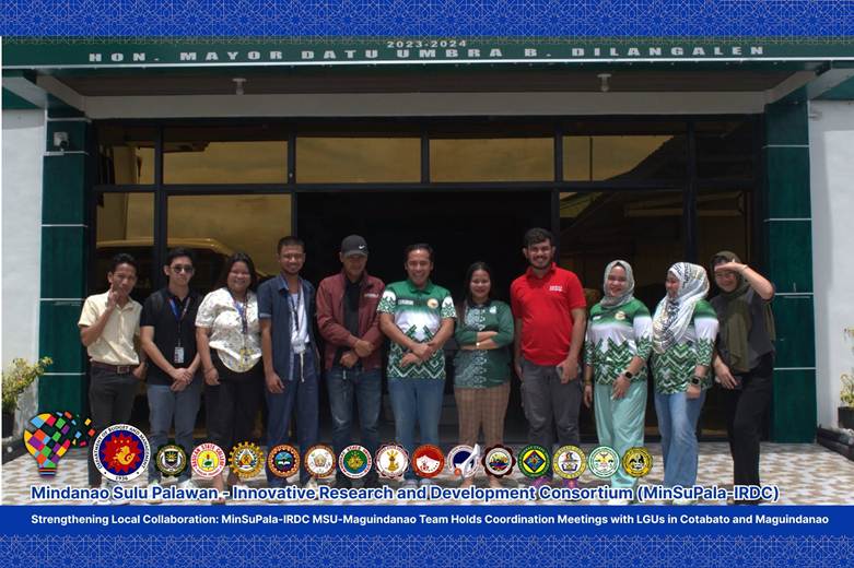
University research team and local government representatives during the July 23–25, 2025 coordination meetings and community prioritization activities for indigenous fish and crop resources under MinSuPala–IRDC Phase 2.
Sustaining Watershed Management Through Institutional and Community Partnerships
The South Upi Forest Watershed Enhanced Protection and Management Plan (2025–2030) provides a five-year framework for continuing watershed protection and sustainable natural resource management. Its long-term effectiveness depends on sustained coordination among the University, MOST–BARMM, local government units, environmental agencies, Indigenous Teduray communities, farmers, and other stakeholders.
Priority actions include integrating watershed protection measures into local development and environmental plans, conducting periodic assessments of forest and water resources, monitoring biodiversity and habitat conditions, strengthening environmental education, and supporting community-based conservation initiatives.
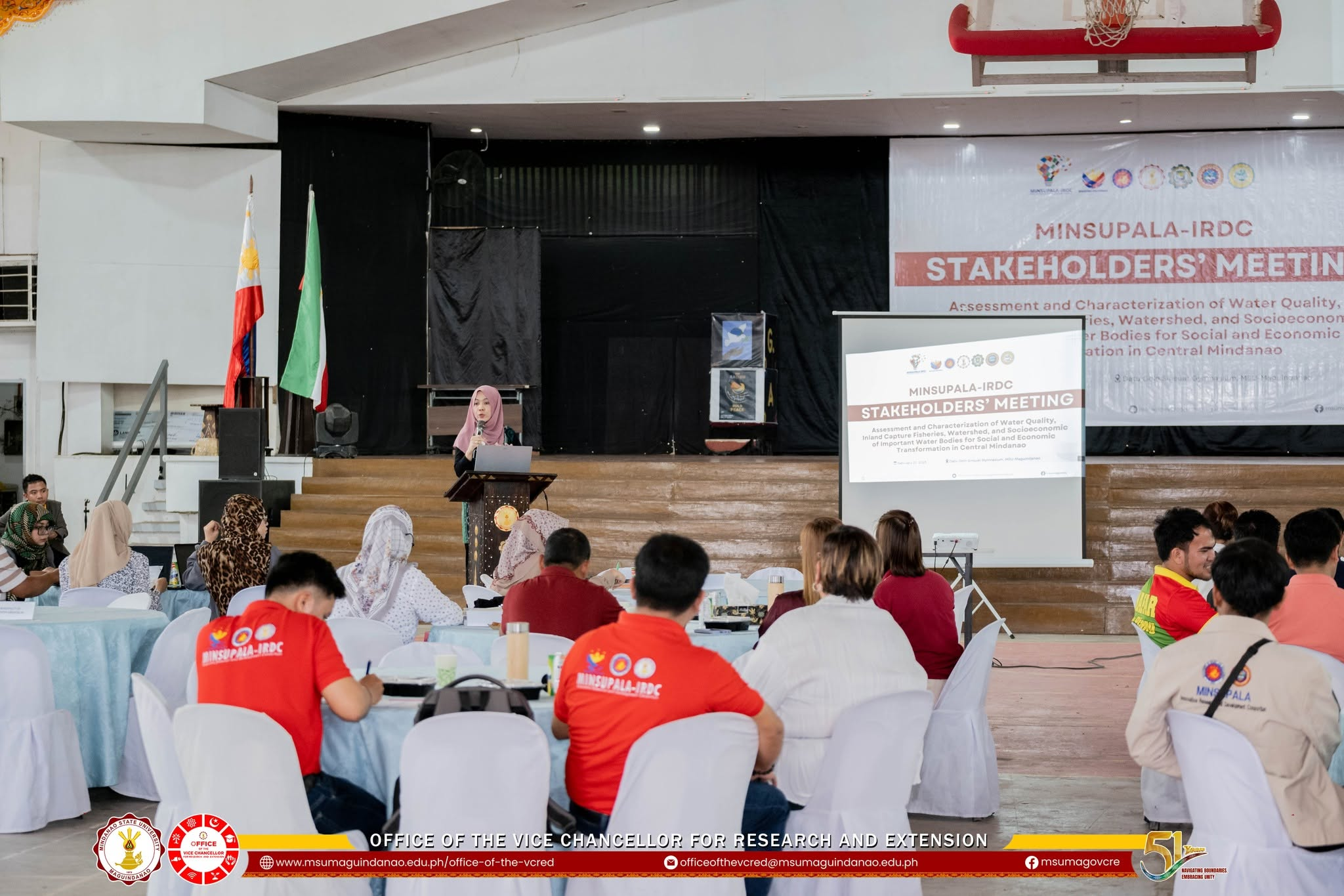
Similarly, research findings from Ligawasan Marsh, Lake Buluan, the Rio Grande de Mindanao, and Lake Lanao can continue to inform location-specific management recommendations, fisheries interventions, water quality monitoring, and future conservation programs.
The University recognizes that effective watershed management requires more than the preparation of a management plan. It also requires sustained implementation, adequate resources, technical capacity, regular monitoring, and active participation from the communities and institutions responsible for protecting these ecosystems.
Through its South Upi Forest Watershed Enhanced Protection and Management Plan, aquatic ecosystem research, stakeholder consultations, technical training, community-based conservation initiatives, and collaborative water quality monitoring, the University demonstrates its institutional commitment to location-specific watershed management and aquatic biodiversity conservation.
By connecting scientific evidence with local knowledge, institutional partnerships, and community participation, the University contributes to protecting aquatic habitats, sustaining biodiversity, promoting responsible fisheries management, and safeguarding natural resources for present and future generations.